Mergelland route by car
The classic drive through the hills of South Limburg, past the three-country point at Vaals, half-timbered villages, sunken lanes and the rolling chalk country. For convertible, touring car, motorbike and camper.
For Garmin, Komoot or TomTom: download the GPX.

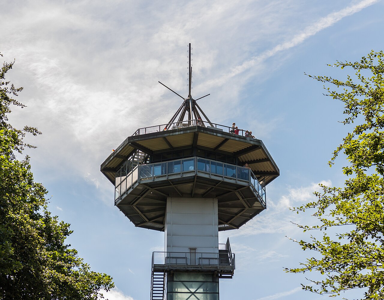
Photos via Wikimedia Commons: three-country point by Agnes Monkelbaan (CC BY-SA 4.0), lookout tower by Dominicus Johannes Bergsma (CC BY-SA 4.0).
The hilliest corner of the Netherlands
South Limburg is unlike the rest of the Netherlands: here the land is not flat but rolls, with hills, sunken lanes, castles and half-timbered cottages you would sooner expect in the Ardennes or the Eifel. The Mergelland route is the classic way to discover it, and by car perhaps the finest: narrow lanes that climb and fall through the chalk country, from one village to the next. About 76 kilometres in all, a full day with all the views, terraces and the three-country point.
You start and finish in Maastricht, the oldest city in the Netherlands, and drive a loop through the hills: past Eijsden on the Meuse, the half-timbered villages of Noorbeek, Slenaken and Epen, up to Vaals and the three-country point (the highest point in the country, where the Netherlands, Belgium and Germany meet), and back via Gulpen and touristy Valkenburg. No motorway, just the sunken lanes the convertible was made for.
The route on the map
A schematic overview by Touren.app, not a navigation map. The exact route opens under “Drive this route” or in Google Maps. Map orientation: north is up.
Plan your own route
The places along the route
1. Maastricht
Maastricht is the lively starting point: a city with a Roman past, the Vrijthof, the Sint Servaas bridge and a Burgundian atmosphere found nowhere else in the Netherlands. From the centre you are out in the hills in no time, across the Meuse and up the slopes.
Practical: car parks around the centre; a good place to start or finish with a terrace on the Vrijthof.
2. Eijsden
Eijsden lies against the Belgian border on the Meuse, with Eijsden castle behind its moats and a small foot ferry across the river. It is the last flat land before the road climbs into the hills; from here the real hill country draws you in.
Practical: park by the centre; the castle park is freely accessible.
3. Noorbeek
Noorbeek is one of the loveliest half-timbered villages of the hills, with white cottages and dark beams around the church, high on the plateau between the valleys. The road to it winds through rolling fields and sunken lanes; here the real touring begins.
Practical: a short stop; park on the edge, the village is small and compact.
4. Slenaken
Slenaken lies deep in the valley of the Gulp, surrounded by wooded slopes and meadows with pollard willows. It is one of the calmest, greenest spots in the hills, loved by walkers and cyclists. A stop on a terrace with a view over the valley is almost obligatory here.
Practical: park in the village; a fine place for a coffee or lunch stop with a view.
5. Epen
Epen lies high above the Geul valley and is known for its tea gardens and the wide views over the rolling land. Around it lie sunken lanes, hillside woods and the famous viewpoint towards the three-country point. This is the hill country at its finest.
Practical: park on the edge; plenty of tea gardens and viewpoints around.
6. Vaals
Vaals lies at the foot of the Vaalserberg, with the three-country point on top: at 322 metres the highest point in the Netherlands, where the borders of the Netherlands, Belgium and Germany meet. There is a lookout tower, a maze and a wide view over three countries. The highlight of the route, literally.
Practical: park at the three-country point (paid); the tower and the border point are a short walk away.
7. Gulpen
Gulpen lies where the Gulp flows into the Geul, a pleasant town with a market, terraces and the well-known Gulpener brewery. It is a good place to come down from the highest hills and catch your breath before you drive to Valkenburg.
Practical: park in the centre; terraces on the market square, and the brewery to visit.
8. Valkenburg
Valkenburg is the tourist heart of the hills: the only hill town with a real castle ruin on a hill, plus the famous marl caves, a lively old centre and a cable car. Busy but worth it, and a fitting close to the drive before you return to Maastricht.
Practical: park on the edge of the centre; the castle ruin and the caves are within walking distance.
Practical: for convertible, motorbike and camper
From which town: the route starts in Maastricht, but you need not start there. Enter your own address or holiday address in the planner, choose your time, and Touren.app rebuilds the same loop from Valkenburg, Gulpen, Vaals or wherever you are staying.
For which vehicle: this may be the very finest scenic drive in the Netherlands, with the winding lanes and climbs of the hills. It works in a campervan too, but mind the narrow, steep lanes and the crowds in Valkenburg.
Difference from the castle route: this Mergelland route is about the landscape: hills, sunken lanes, half-timbering and the three-country point. If you would rather follow the castles of South Limburg, see our castle route South Limburg; it shares the region but has its own line past Hoensbroek, Valkenburg and Neercanne.
Best season: April to October, with the fresh green of late spring and the colours of autumn as highlights. Summer weekends are busy, especially in Valkenburg; drive early or out of season and the sunken lanes are almost your own.
Why these roads: we deliberately let the route take the narrow plateau and valley roads rather than the through N-roads. That costs some extra climbing and descending and delivers exactly the drive you come to South Limburg for.
Reviews from drivers
Reviews appear here with vehicle, experience and month of the drive. A score cannot be bought here, and this stays empty until someone has really driven it.
Share this route or save it
Share this drive with whoever should drive it
Or email it to yourself, for the road
Email this route to yourselfFrequently asked questions
How long is the Mergelland route by car?
About 76 kilometres, with some 1 hour and 45 minutes of pure driving, measured via Google Maps with motorways avoided. With the three-country point, the villages and a terrace it is a full, beautiful day.
What is the three-country point?
The point on the Vaalserberg near Vaals where the borders of the Netherlands, Belgium and Germany meet. At 322 metres it is also the highest point in the Netherlands, with a lookout tower, a maze and a view over three countries.
What is the difference from the castle route South Limburg?
The Mergelland route is about the hill landscape: hills, sunken lanes, half-timbered villages and the three-country point. The castle route South Limburg shares the region but follows its own line past the castles. We keep them deliberately separate.
Is the route suitable for convertible, motorbike and camper?
Yes, and for convertible and motorbike it is one of the finest routes in the country. With a camper, mind the narrow, steep lanes and the crowds in Valkenburg; park on the edge of the villages.
Are the exports really free?
Yes, free with a Touren.app credit on them. You never pay us for exports; those who want to drive ad-free and offline choose Plus.
Keep exploring
Fancy this drive, but from your own front door?
Touren.app rebuilds the same Mergelland route from any starting point in South Limburg, within the time you have. Choose your vehicle, set your time, and drive.
Generate your version of this route