The Côte des Blancs scenic drive
The vineyard loop through the Chardonnay heart of Champagne: about 40 km climbing from the giant bottle of Cramant, over the steep chalk slopes and the grand cru villages Avize and Le Mesnil-sur-Oger, to Vertus and Mont Aimé, a 240-metre butte with a panorama over the whole Côte. Back on the faster road. Vineyard lanes and D-roads only, no motorway. For a rental car, convertible or motorbike.
Plan for: half a day to a full day with the wine villages and a cellar visit
Drive this route from your locationOpen in Google MapsFREE Download GPXFREEFor Garmin, Komoot or TomTom: download the GPX.


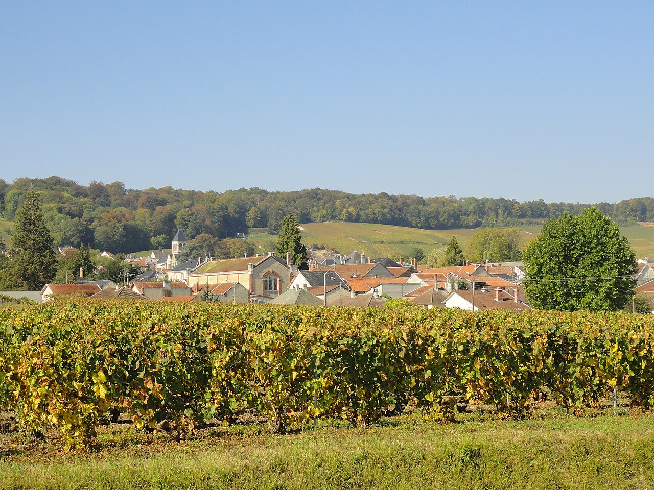
Photos via Wikimedia Commons: Côte des Blancs by Luc Coekaerts (CC0), Cramant by Tomas e (CC BY-SA 4.0), Vertus by Fab5669 (CC BY-SA 4.0).
The Chardonnay heart, from the giant bottle to the panorama
This is the drive for lovers of the blanc de blancs: the Côte des Blancs, the narrow chalk strip south of Épernay where Champagne is almost entirely Chardonnay. No motorway, but the vineyard lanes that climb the steep slopes past a chain of grand cru villages.
Built as a climb: you begin in Cramant, recognisable by the giant bottle monument at the edge of the village and the first wide view over the plain. Then come Avize and Le Mesnil-sur-Oger, the heart of the Chardonnay, where the most famous blanc de blancs houses have their plots. By way of Vertus you climb to Mont Aimé, a lone 240-metre butte with a panorama over the whole Côte as far as the plain of Châlons.
The Touren.app promise: a measured route, not a rough sketch. You get the kilometres, the honest driving time, a free GPX for your sat-nav and the route straight into Google Maps. The villages and Mont Aimé are free; for the cellars you book ahead. Drive out on the vineyard lane and return on the faster D9.
The route on the map
A schematic overview by Touren.app, not a navigation map. The exact route opens under “Drive this route” or in Google Maps. Map orientation: north is up.
Plan your own route
The 5 places along the route
1. Cramant
Cramant is the gateway village of the Côte des Blancs, and nobody drives past it: at the edge stands a giant bottle monument some eight and a half metres tall, repainted in 2023, with a little belvedere garden and orientation tables beside it. From here you get the first wide view over the Chardonnay plain and the butte of Saran. A light-hearted start for the climb that follows.
Practical: the giant bottle and the belvedere garden are free, all year. Park in the village and walk the last stretch. As of 11 July 2026.
2. Avize
Avize is one of the great names of the Côte des Blancs: a grand cru village where the Chardonnay is at its purest. All around, the vineyards climb the chalk slope steeply; in the village stand the Gothic church and well-known blanc de blancs houses and a wine school. A good place to grasp why this strip is named apart.
Practical: the village and vineyards are free to see. Tastings are possible at several houses by booking (for example the Sanger tasting room from about 10 euros, often closed at weekends). As of 11 July 2026.

3. Le Mesnil-sur-Oger
For many lovers Le Mesnil-sur-Oger is the absolute heart of the blanc de blancs: here lie the plots of the most legendary Chardonnay, including walled vineyards that are rarely public. What you can do is the Musée de la Vigne et du Vin Launois, where you see the old presses and tools and finish with a tasting. A quiet, real village in the middle of the chalk.
Practical: the great names (Salon, Krug, Clos du Mesnil) are not public. The Launois museum works by booking and lasts about two hours with a tasting; confirm the price when you book. As of 11 July 2026.
4. Vertus
Vertus closes the row of grand cru villages and is a Petite Cité de Caractère: an old town with the Romanesque church of Saint-Martin built over springs, some wash houses and a relaxed feel. It is the last stop before the climb to Mont Aimé, and a pleasant place for a coffee or lunch before you head up the butte.
Practical: the town and church are free to see. Park in the centre. From here it is another quarter of an hour to the foot of Mont Aimé. As of 11 July 2026.
5. Mont Aimé
Mont Aimé is the crown of the drive: a lone 240-metre butte that rises clear of the Côte, with an orientation table, an obelisk, the remains of a medieval castle and a panorama over the whole Chardonnay strip far into the plain. At the top it is free and open all year; you are often alone there, with the wind and the view.
Practical: the walking paths and the orientation table are confirmed and free. Car access is not officially confirmed: expect a narrow, winding access road and a free car park along the D9, and check access on the spot. You walk the last stretch to the top. As of 11 July 2026.
Practical: for a rental car, convertible or motorbike
Direction and loop: drive out southward on the vineyard lane through the villages, with the rising chalk slopes to Mont Aimé as the climax, and return on the faster D9 or D951. That way you avoid re-driving the narrow vineyard lane and see the fine stretch just once, in the right direction.
The roads: the route runs on narrow vineyard lanes through the chalk; the loose tracks between the plots are very narrow, so keep to the through D-roads (D9, D10). It is the slowest and most scenic drive of the cluster. In a convertible you want the roof open here.
Tasting and driving: France has a 0.5 g/L blood-alcohol limit, and 0.2 g/L for drivers with less than three years' licence. A glass of champagne goes a long way, so spread your tasting or use the crachoir: spitting after tasting is entirely normal at the houses. If someone rides with you, agree on who stays sober. To taste properly at several houses, a chauffeured tour from Épernay is the safest choice; drive the route yourself another day.
Best time: high season runs from May to October; during the grape harvest (September) the slopes are at their loveliest. The villages, the giant bottle of Cramant and Mont Aimé are free all year; for the Launois museum in Le Mesnil and the tasting rooms in Avize and Oger you book ahead, and note that some close at weekends.
Fuel and tolls: fill up in Épernay or Vertus. There are no tolls on this route; it runs entirely on free roads.
Reviews from drivers
Reviews appear here with vehicle, experience and month of the drive. A score cannot be bought here, and this stays empty until someone has really driven it.
Share this route or save it
Share this drive with whoever should drive it
Or email it to yourself, for the road
Email this route to yourselfFrequently asked questions
How long is the Côte des Blancs drive?
About 40 kilometres as a loop, with some 1 hour 10 of pure driving, measured via a route planner. Because of the slow vineyard lanes and with one proper visit it is a full day; without a visit, a lovely half day.
What is the difference from the other Champagne routes?
The iconic drive and the two-day Vallée de la Marne lie north and west of Épernay; this route is the chalk and the Chardonnay to the south, the Côte des Blancs. Different villages, different landscape: one narrow strip of grand cru slopes with Mont Aimé as the panoramic climax.
Can I visit the famous houses of Le Mesnil-sur-Oger?
The biggest names (Salon, Krug with the Clos du Mesnil) are not open to the public. You can, however, visit the Musée de la Vigne et du Vin Launois in Le Mesnil, by booking, with a tour of about two hours and a tasting.
Can Mont Aimé be reached by car?
The walking paths, the obelisk and the orientation table on Mont Aimé are free and open all year. Car access is not officially confirmed: expect a narrow, winding access road and a free car park along the D9, and check access on the spot. You walk the last stretch.
Does the route really follow the vineyard lanes and not the motorway?
Yes. The route follows narrow vineyard lanes and the D-roads through the chalk. The measured leg speeds of 25 to 37 km/h confirm it is not a motorway; it is in fact the slowest drive of the cluster.
Are the exports really free?
Yes, free with a Touren.app credit on them. You never pay us for the GPX or the Maps export.
Keep exploring
Drive this route from your own starting point?
Download the free GPX for your sat-nav or open the route in Google Maps, and drive the Côte des Blancs loop whenever it suits you.
Generate your version of this route